
Project Tools.
Built for the Field.
Offline-first observation capture. GPS-and-compass-stamped photos. The compliance record built from the work itself. Used by crews in the field, and the office that has to make the record stand up.
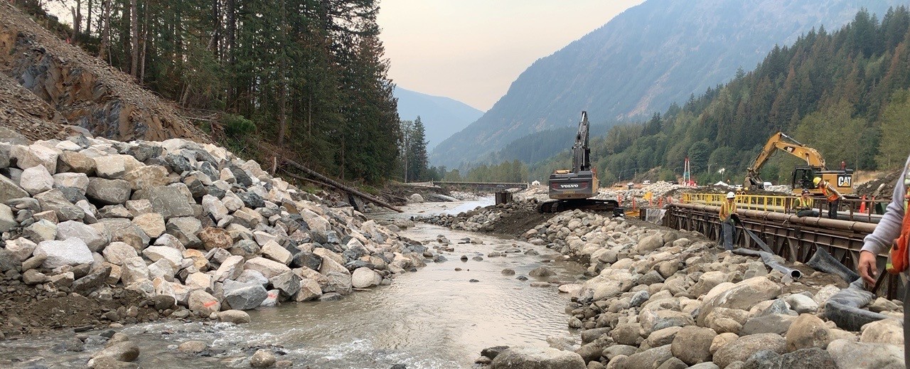
Where the work happens. BirdDog captures the evidence on the ground and assembles the record back at the office.
The boring stuff, done right.
Field crews capture. Reports assemble. The same record holds up wherever it lands: a regulator, a nation, an operator, your own audit.
Offline-first
Zero cell signal? Full app. Capture photos, log observations, mark map locations. Auto-syncs the moment you're back in range.
GPS and compass-stamped photos
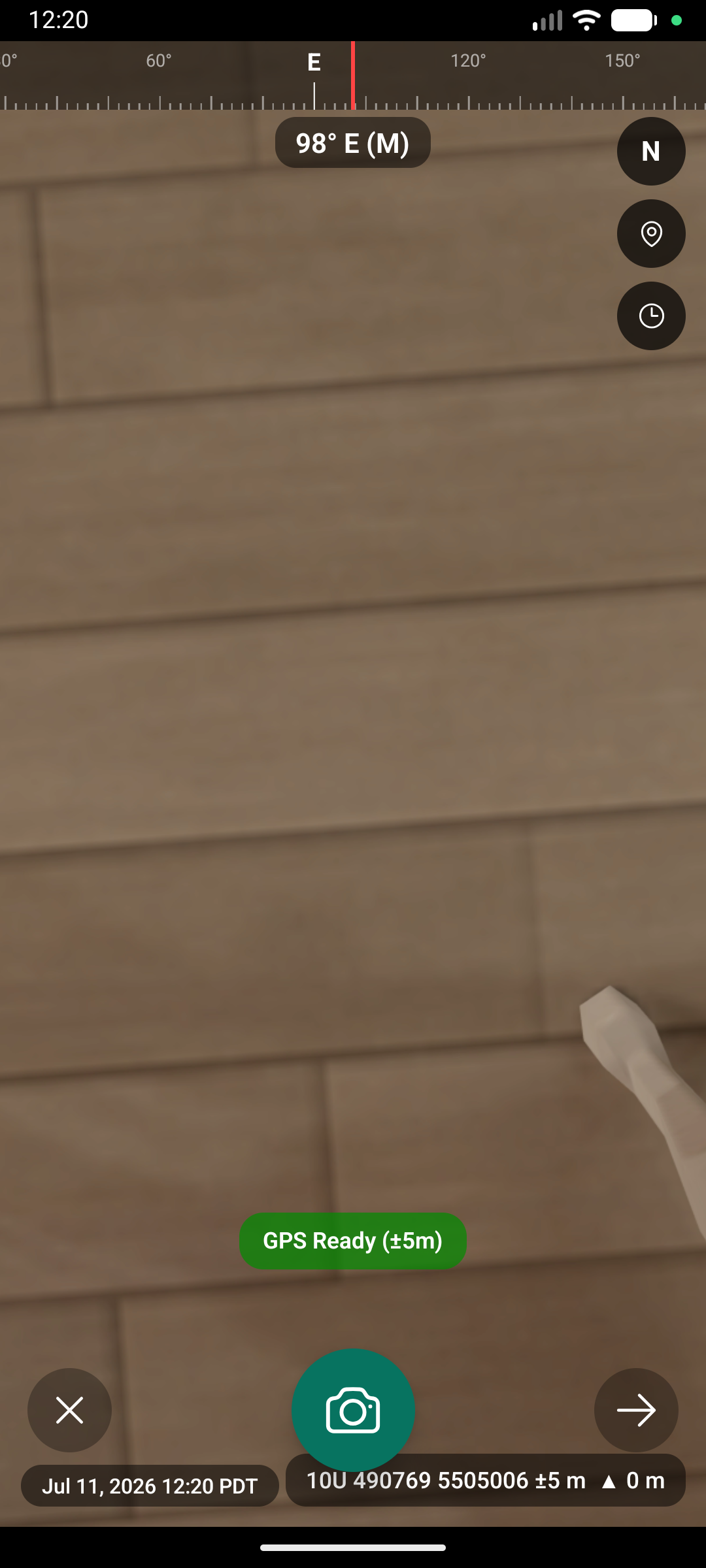
Every photo is watermarked at capture with UTM coordinates, bearing, and accuracy. Evidence that holds up, without anyone touching metadata.
Operational map layers
Wells, pipelines, roads, watercourses, watersheds, and reference grids baked in. NTS, BCGS, DLS. No swapping apps.
Configured to your operation
Captures shaped to the work you do. Environmental compliance ships with risk ranks (Positive, Low, Medium, High) and categories like soil handling, waste, watercourse, wildlife. A different operation gets a different setup.
Reports that tell the story
Daily logs, compliance rollups, evidence packages. Assembled from the observations the field captured, branded with your company. The same record serves a regulator, a nation, an operator, an internal review.
Track work over time
An observation isn't a snapshot. When crews return to the same site, updates layer on. The original record carries the full history: who came back, what changed, what's resolved, what's still open.
Audit-grade evidence
Pin observations to specific commitments and requirements. When the auditor asks how a requirement was met, the evidence is the observations themselves: GPS-stamped, photo-attached, time-coded.
Custom forms
Your documents, not ours. The forms you already use, rebuilt field-native: every field GPS-stamped, photo-attached, tamper-evident. A new client with a new template gets added, not hard-coded.
Your forms, made field-native.
This is what environmental, safety, and quality teams need most. A rigid app with a fixed set of built-in forms can't serve a firm that runs dozens of them, with a new variation for nearly every client and regulator. BirdDog can, because the forms are built to your work, not hard-coded into the app.
The forms you already use
Environmental, safety, and quality teams don't need one form. They need theirs, and a new variation for nearly every client, project, and regulator. Bring the document you already run on, and we rebuild it field-native from the pieces the work needs: text, dropdowns, photos, GPS points, risk ranks, signatures.
Every field carries the evidence
A BirdDog form is not a flat PDF. Location, time, and photo are baked into the fields that need them, watermarked at capture and tamper-evident. What the crew records is structured, defensible evidence from the moment it's taken.
The reports assemble themselves
The same captured data rolls up into whatever the work demands: a daily log, a compliance rollup, a nation report, an evidence package. Build the form once, and the reports fall out of it. A returning crew layers new entries onto the same site's history, so the record keeps growing.
Bring us the forms you already use. We'll make them field-native, GPS-stamped, and audit-ready, and the reports assemble themselves.
From a site visit to a finished record, without a spreadsheet in sight.
Capture in the field
Foreman opens the project, taps an observation, takes a photo. GPS, bearing, and accuracy stamp on automatically at capture. Risk-rank it, categorize it, move on. Works without a bar of signal.
Sync when you have signal
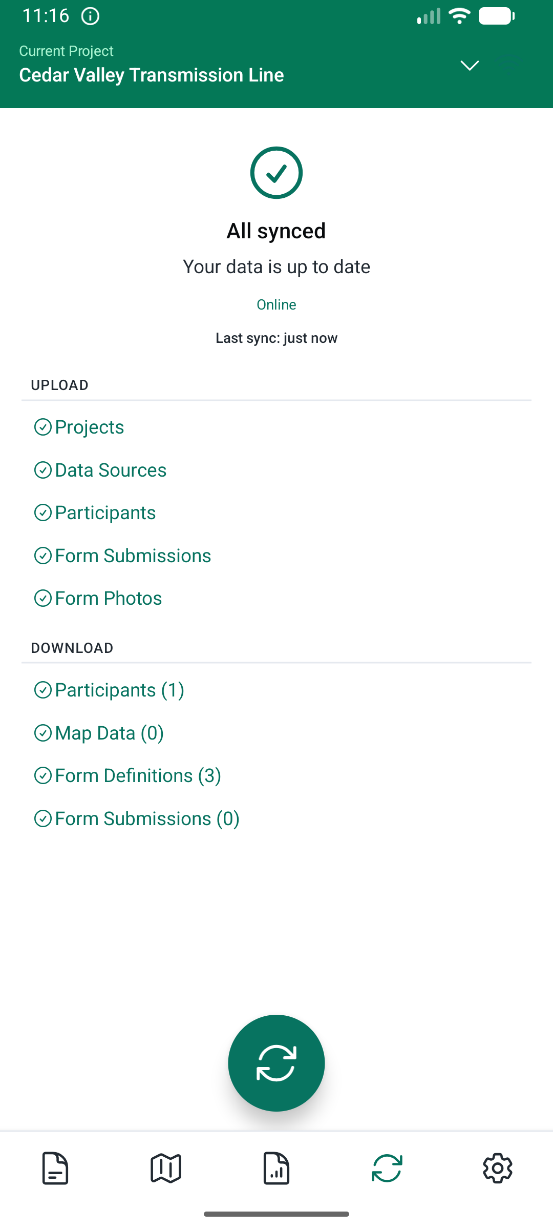
Back at the truck, in town, at camp: the moment a connection is there, photos and observations sync. No manual upload, no losing the day if the phone dies.
Assemble the record
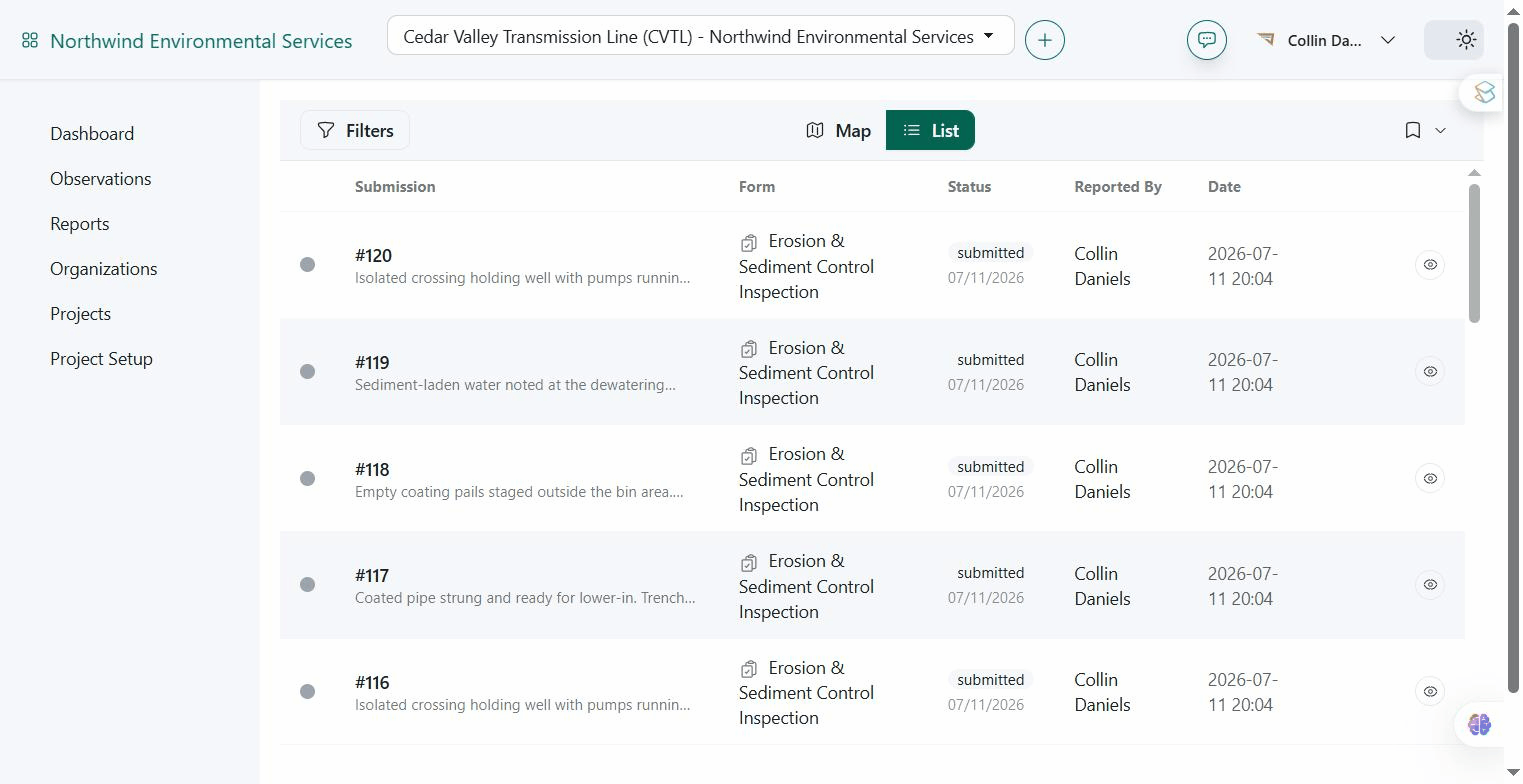
The same observations roll up into whatever record the work demands. Daily logs. Compliance rollups. Stakeholder updates. Built on a laptop or in a truck, sent wherever the audience sits: email, text, print, save. One source, many audiences.
A clean view of the work. And the gaps.
Open items, risk-ranked. Categories rolled up. Compliance trends per project. Drill into a single observation, or pull a stakeholder-ready PDF in one click.
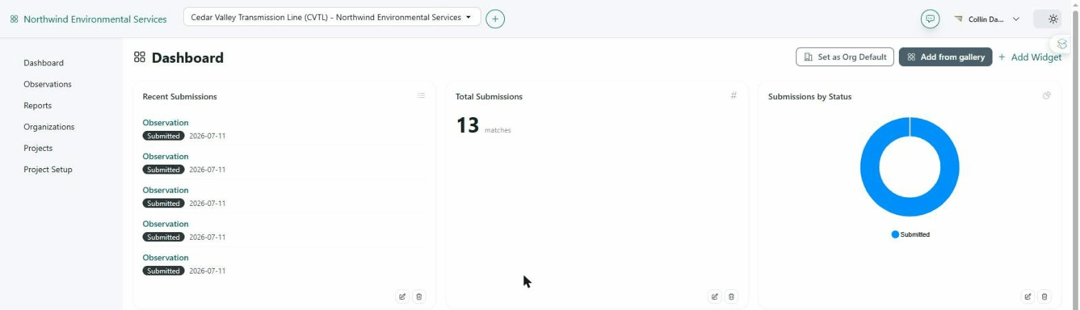
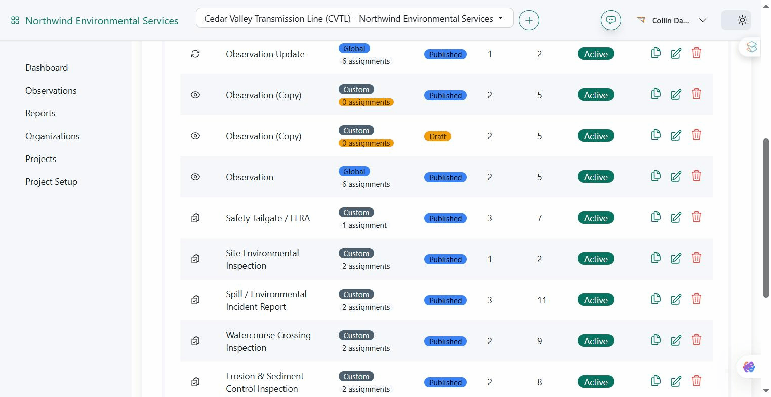
Every form in one place
The forms this operation actually runs, section and field counts at a glance. Built to your templates, not chosen from a fixed menu.
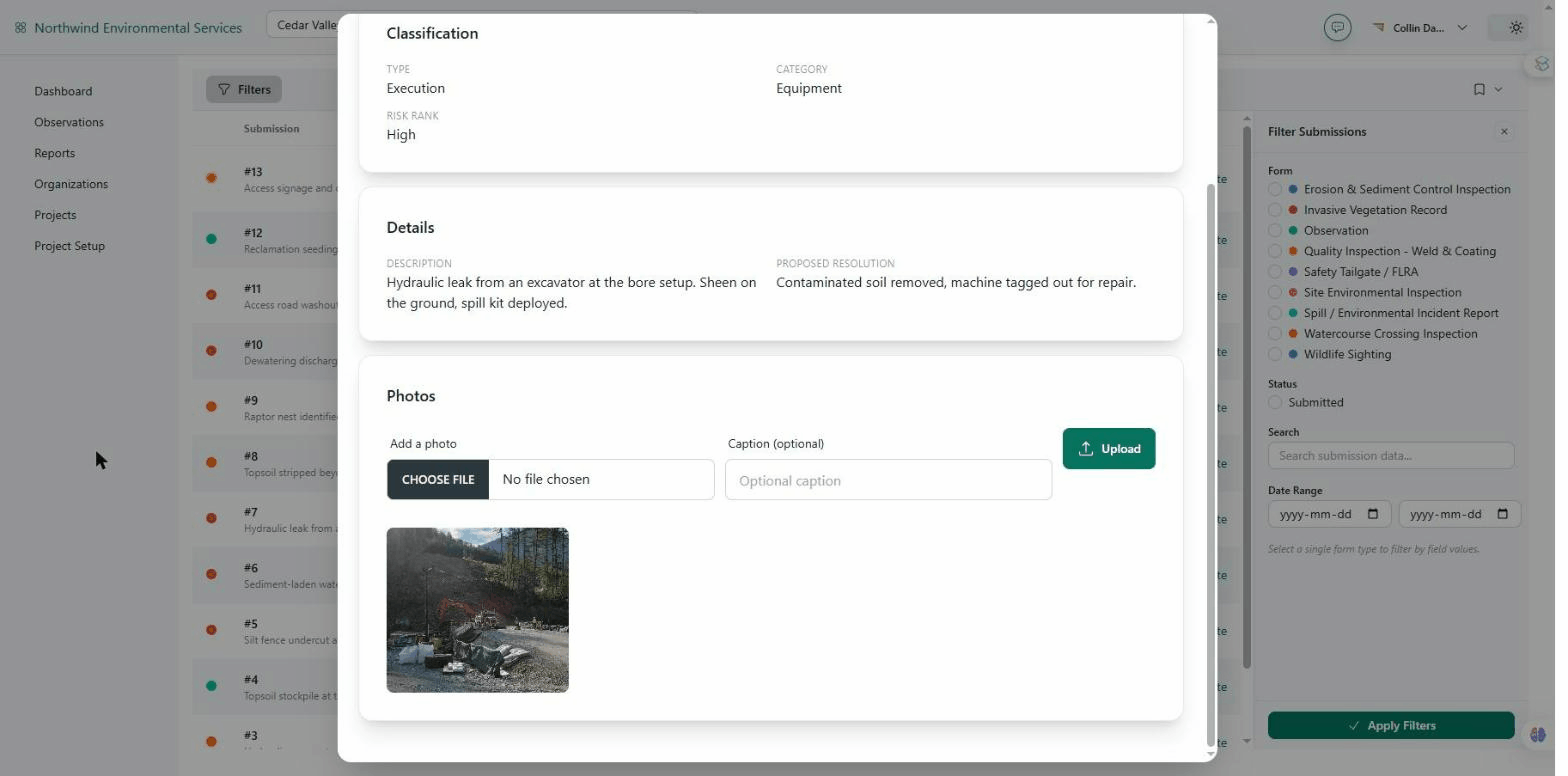
Every observation is evidence
Type, category, risk rank, the note, and the field photo, together in one record. GPS-stamped at capture, not retyped from a notebook. The kind of proof that holds up for whoever's asking.
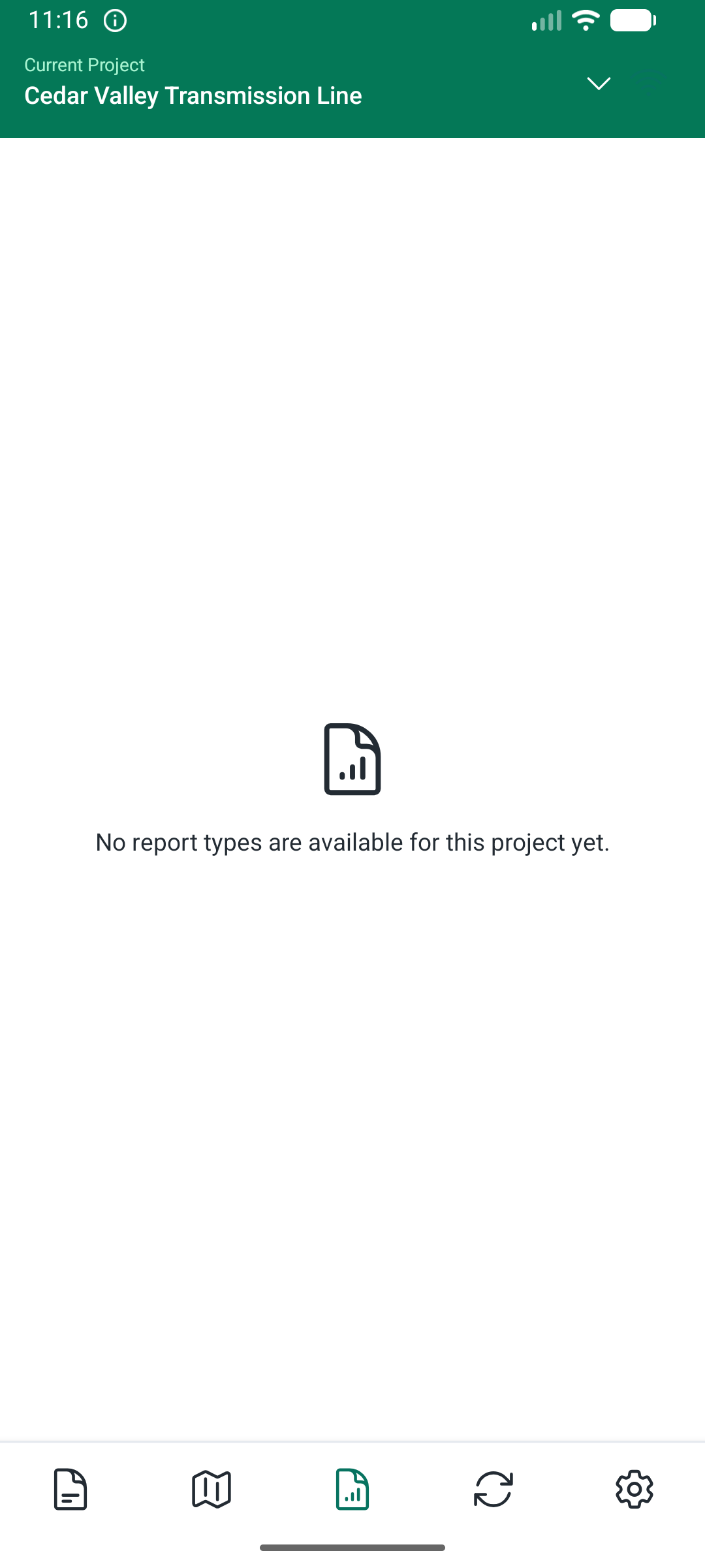
Same on every device
Foreman wants to see the daily report from his truck? It's there. Same data, same format, same signature line.
Configured to the work.
BirdDog is set up to match how your operation actually runs. Same code underneath, very different shapes on top. A few of the ways customers run it:
Compliance and reporting on real ground
Crews capture observations across sites: wellsites, pipelines, reclamation areas, watercourses. Photos GPS-and-compass-stamped. Daily logs, compliance summaries, and incident reports assembled on company letterhead. This is what most BirdDog customers are doing today.
Who's accountable. Who signed off.
Multi-stakeholder requirement tracking for owner and producer-class customers. The accountable party named per requirement, the consulted parties on record, the evidence trail attached. Built for projects where commitments outnumber the people tracking them.
Many clients, one workspace
One field worker, multiple organizations, multiple active projects. Switch context in one tap, see only what that engagement covers, keep client data isolated. Built into the platform, not bolted on.
If your operation looks different from any of these, that is not a problem. The platform is configured per customer at onboarding. You walk us through the work, we set BirdDog up to match.
See it on your work.
Thirty-minute call. Tell us about your operation: a project, a site, a compliance commitment. We'll show you BirdDog working against it. You'll know if it fits before you commit anything.